Guiding the world through Atlanta’s Last Mile
- Role
- UX Lead
- Timeline
- 10 weeks · 2026
- Client
- Atlanta Host Committee
Problem
Around 300,000 fans, most from outside Georgia, will pour into the same downtown streets in the same 90 minutes, all asking one question: which way do I go?
Solution
A wayfinding strategy for the Last Mile: mapped routes and friction points, and three zones that decide what every sign says and where it stands.
Impact
The framework for Atlanta’s 8 World Cup matches, built with students across SCAD majors and carried into production.
Now in production: see the Last Mile signage live in Atlanta.
See it live ↗This page is walked like the Last Mile. Watch the marker in the corner: it counts down to the stadium as the page moves through the three zones I designed.
01 · The Challenge
Moving 300,000 Fans to the Stadium
It’s a city pulled toward one magnetic moment. With Atlanta United’s record crowds, U.S. Soccer’s new headquarters and an NWSL expansion team, Atlanta is becoming “Soccer Town, USA.” For eight matches, it becomes the epicenter of global soccer.
- ~300K
- unique spectators across the 8 World Cup matches in Atlanta
- 75%
- will travel from outside Georgia, from other states or other countries
- 1 mile
- between the Fan Festival and the stadium, through downtown streets
Matchday clock
to kickoff
Early
The first fans trickle in. The streets are still calm.
Core tension
“Which way do I go?”
When tens of thousands of first-time visitors ask the same question at the same moment, the Last Mile, the final walk from transit, hotels and the Fan Festival to the gates, becomes the highest-risk zone of the event.
The ask
Design a safe, engaging, FIFA-compliant Last Mile framework that ensures smooth crowd movement while delivering a world-class fan journey that celebrates Atlanta’s identity.
02 · In the Street
Walk the Last Mile
From the station exit to the stadium gates, with every sign where the strategy put it. Scroll to walk the Last Mile: the street stays in line drawing, so only our signage carries color.
Zone 1 · Orientation
Five Points Station Exit
Out of the station, fans need one thing first: which way is the stadium.
03 · Research
Lessons From Past Events
We analyzed three recent mega-events, the Super Bowl in Atlanta, the FIFA World Cup in Qatar 2022 and Russia 2018, and pulled out what actually moved people.
- 01Super Bowl, Atlanta
- 02FIFA World Cup, Qatar 2022
- 03FIFA World Cup, Russia 2018
- 93%
- movement accuracy in Qatar 2022 when digital and physical signage were integrated and monitored in real time
- 40%
- less backtracking and stopping when wayfinding is clear and unambiguous
- 23%
- more navigation errors when people can’t find their next direction within 3 seconds
- 2–3 km
- from venues, FIFA events needed temporary city-wide wayfinding to keep crowds flowing
Pre-Game vs. Post-Game
Focused · Converging · On the clock
Fan behavior
- Fans move with clear intent and anticipation.
- Movement speeds up once the destination is visible.
- Groups accept density if movement feels continuous.
- Hesitation happens at transitions: exits, crossings and security.
Flow risk
- Transitions disrupt walking rhythm.
- Sharp turns, unclear splits or too much information cause ripple stops.
Released · Dispersed · Emotion-driven
Fan behavior
- Fans split toward many destinations.
- Emotions range from celebration to frustration and fatigue.
- People pause, linger or follow crowds.
- Tolerance for confusion is low.
Flow risk
- Shared exits create chokepoints.
- Visually dominant routes pull crowds unintentionally.
- Friction spikes where paths narrow or rules change.
Evaluation matrix
Evaluation Metrics
We set baselines and success metrics for every route, so each proposal could be user tested, iterated and grounded in research.
- 01
Decision-Point Density
How many choices a route asks of people, and how often.
- 02
Route Legibility
Time to orientation at key junctions, kept low by fewer choice points and a clear forward direction.
- 03
Landmark Anchoring
Whether fans can recognize major junctions, so a route works for both arrival and departure.
- 04
Error Recovery Cost
A wrong turn costs more than distance: it creates stress, breaks momentum and ripples into congestion.
- 05
Flow Stability Under Density
Whether movement stays continuous as crowds grow: lane formation, steady walking speed, signs still visible.
- 06
Human Behavior Alignment
Support for instincts like crowd-following and reassurance-seeking: less hesitation, fewer micro-stops.
04 · Movement Routes
Mapping Downtown Atlanta
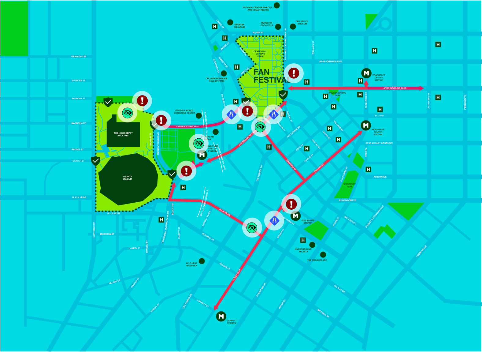
Layer by layer: where fans start, the corridors they’ll take, where signs belong, and where the street pushes back.
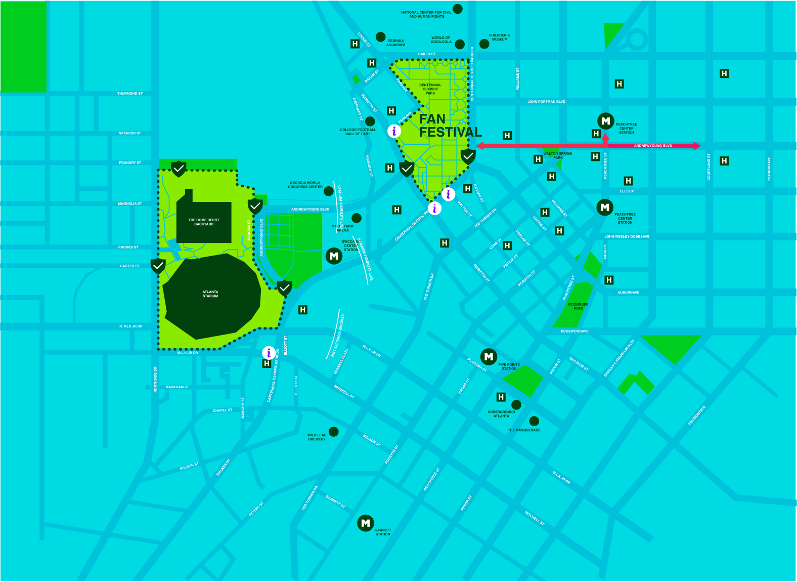
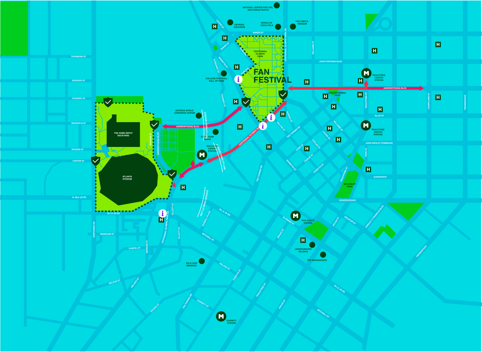
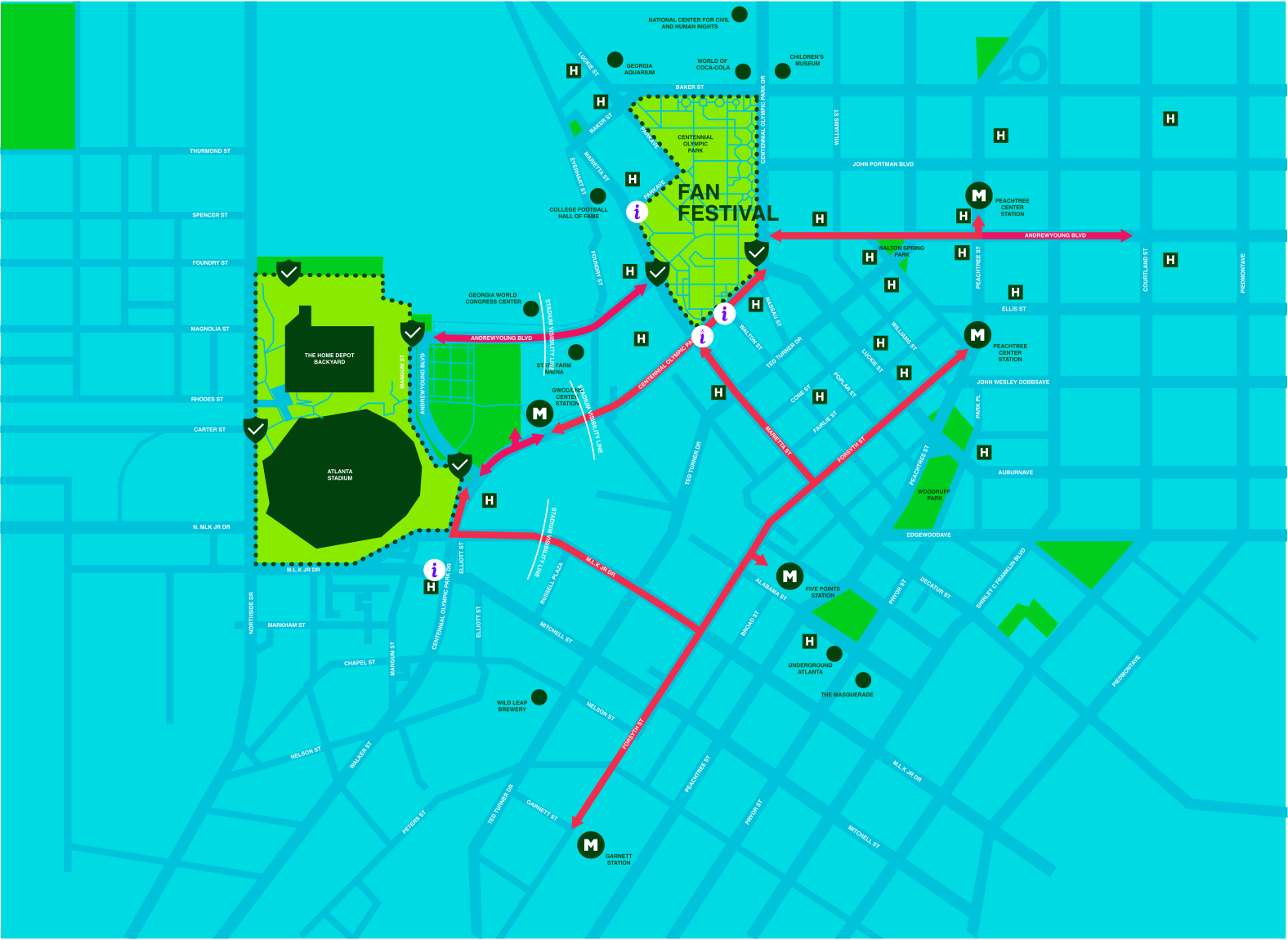
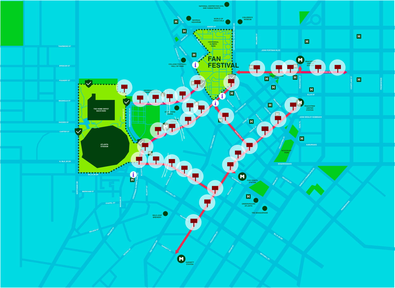
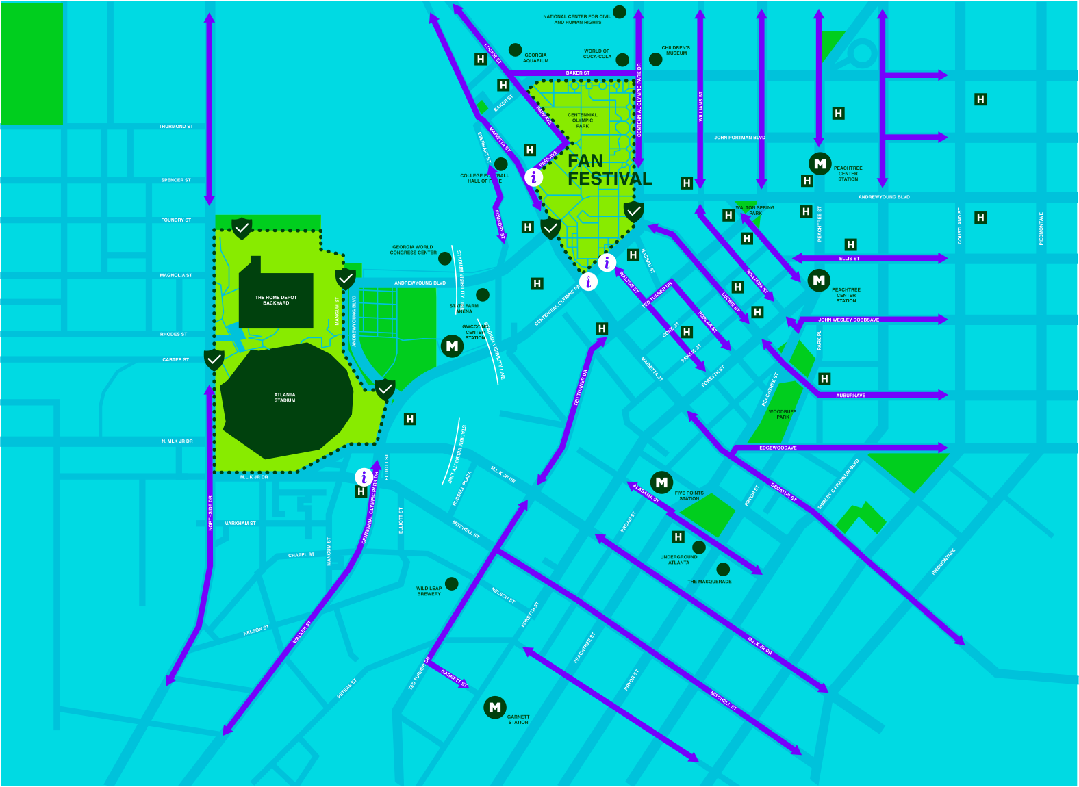
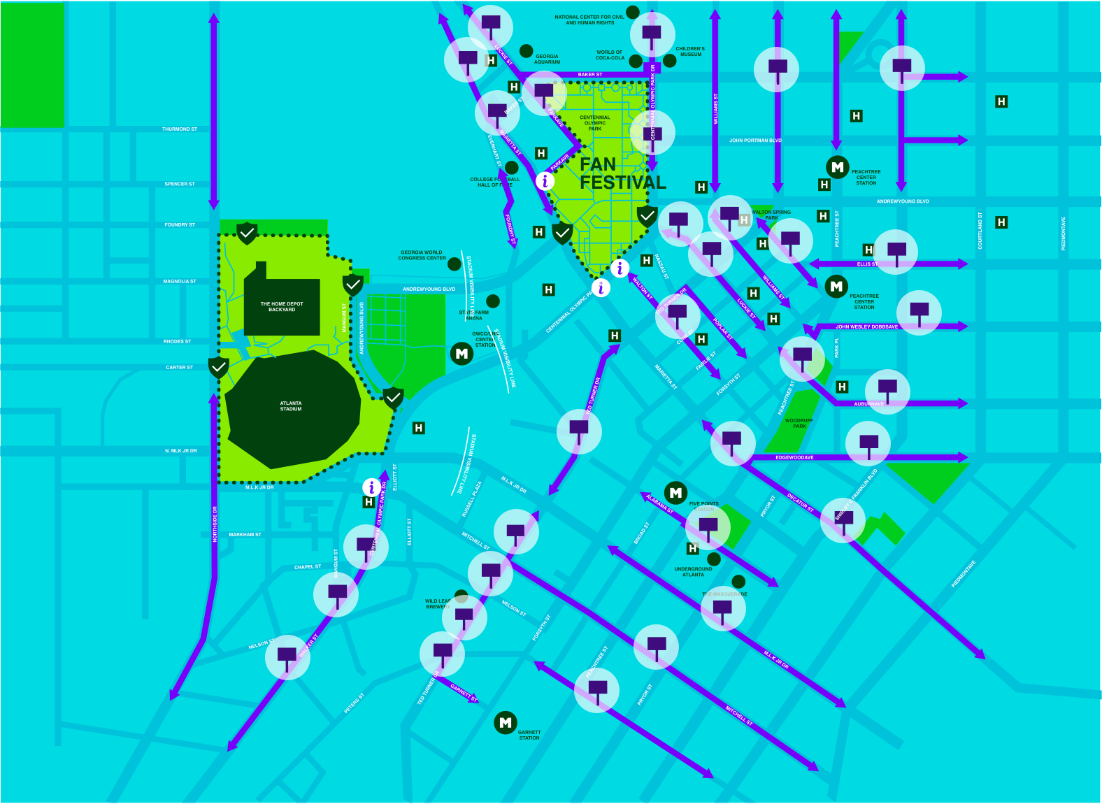
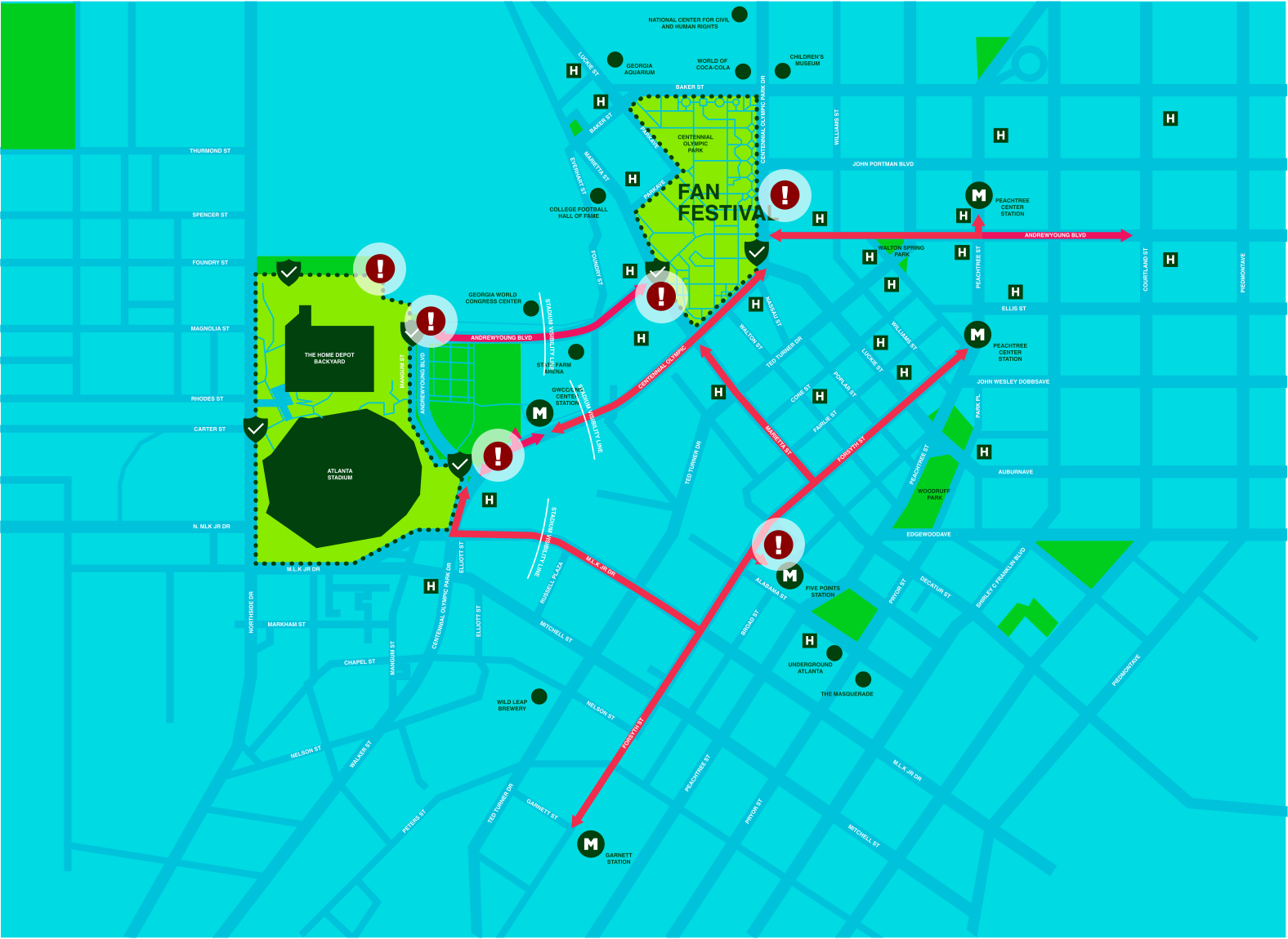
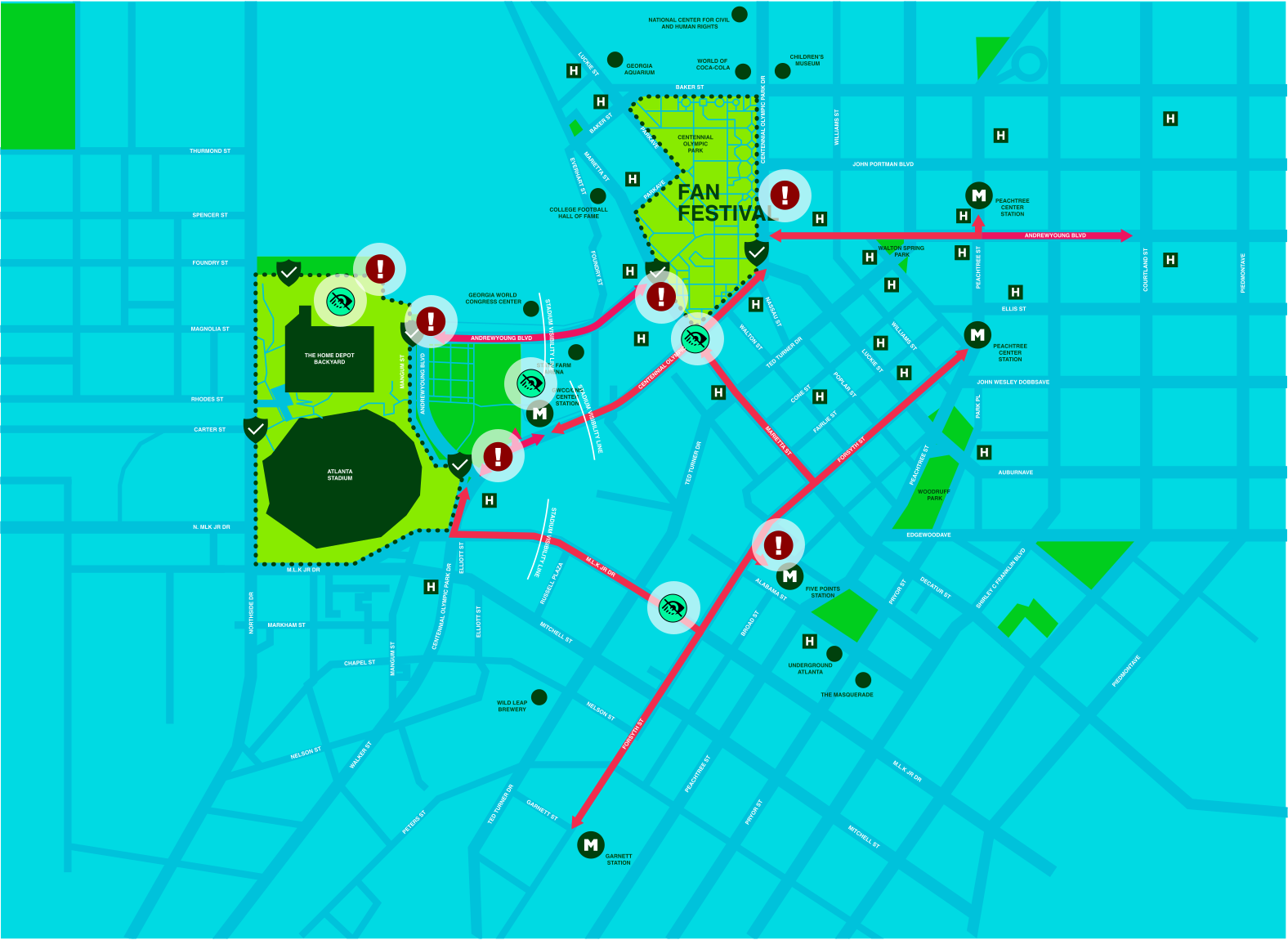
The area
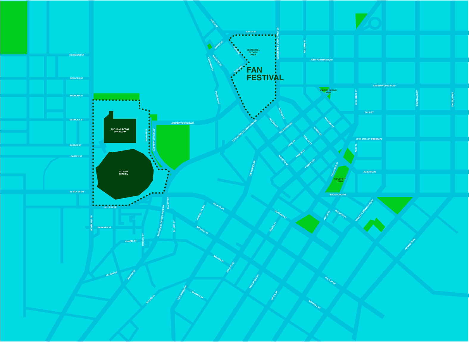
A Mile of Downtown
The Fan Festival at Centennial Olympic Park and Atlanta Stadium sit about a mile apart, with the city’s busiest blocks in between.
The area
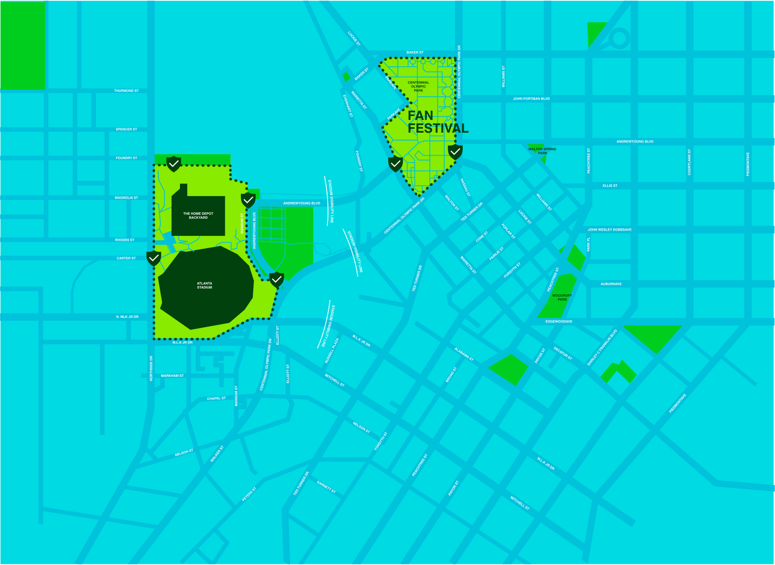
Fan Fest & Security Zones
Security perimeters and gates decide where fans can and can’t walk, and where queues will form.
Security Security gate
The area
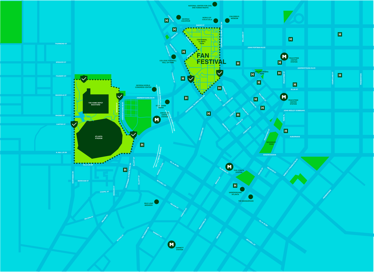
Where Journeys Start
MARTA stations, hotels and points of interest: every place a fan will begin their Last Mile.
MMARTA HHotels
Primary routes
Hotels → Fan Fest
Primary corridors carry the most people, so they’re designed for smooth flow through clarity and reassurance.
Primary routes
Fan Fest → Stadium
The match-day spine: the walk from the festival to the gates.
Primary routes
MARTA → Stadium & Fan Fest
Transit riders arrive in waves, so these routes have to absorb a whole train at once.
Primary wayfinding
Signs Where Decisions Happen
We concentrated signage at intersections, where decisions occur, errors start and flow breaks down, instead of lining every block.
- 90–120 m
- between decision points. People hold a direction for about 1.5–2 minutes of walking.
- ≤ 3 s
- to orient at an intersection. Past that, hesitation and backtracking rise 20–25%.
Secondary routes
Routes That Forgive Mistakes
Secondary routes absorb wrong turns, relieve congestion in moments of doubt and guide people gently back to a primary route.
Secondary wayfinding
Corrective Signals
Secondary signs intercept errors early and lower the cost of recovering from them.
- 1–2
- intersections: the window where wrong-turn recovery works best.
- 1.5–2 min
- of walking: how long people can hold a direction in mind.
Friction points
Bottlenecks
Where routes merge and narrow, crowds compress.
Friction points
+ Visual Obstructions
Construction, fences and barriers hide the next turn.
Friction points
+ Narrow Sidewalks
Some blocks can’t hold two-way traffic, let alone a crowd. These are where guidance matters most.
05 · On the Ground
Walking the Routes
We walked the routes ourselves and photographed every point where we hesitated, then told it through the people who’ll feel it most.
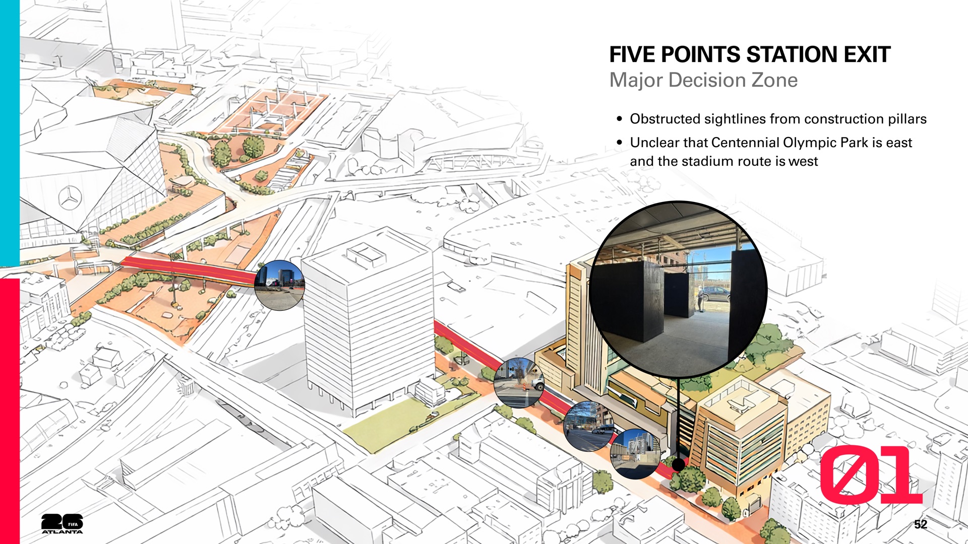
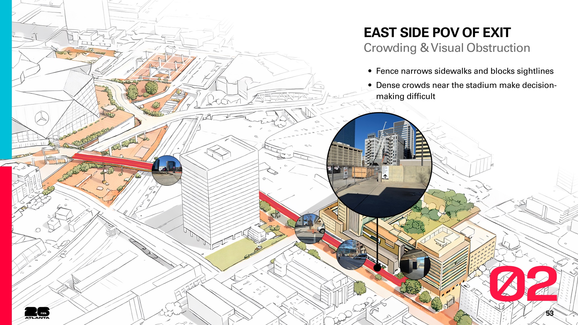
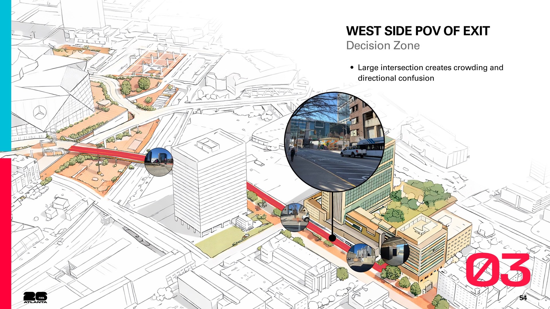
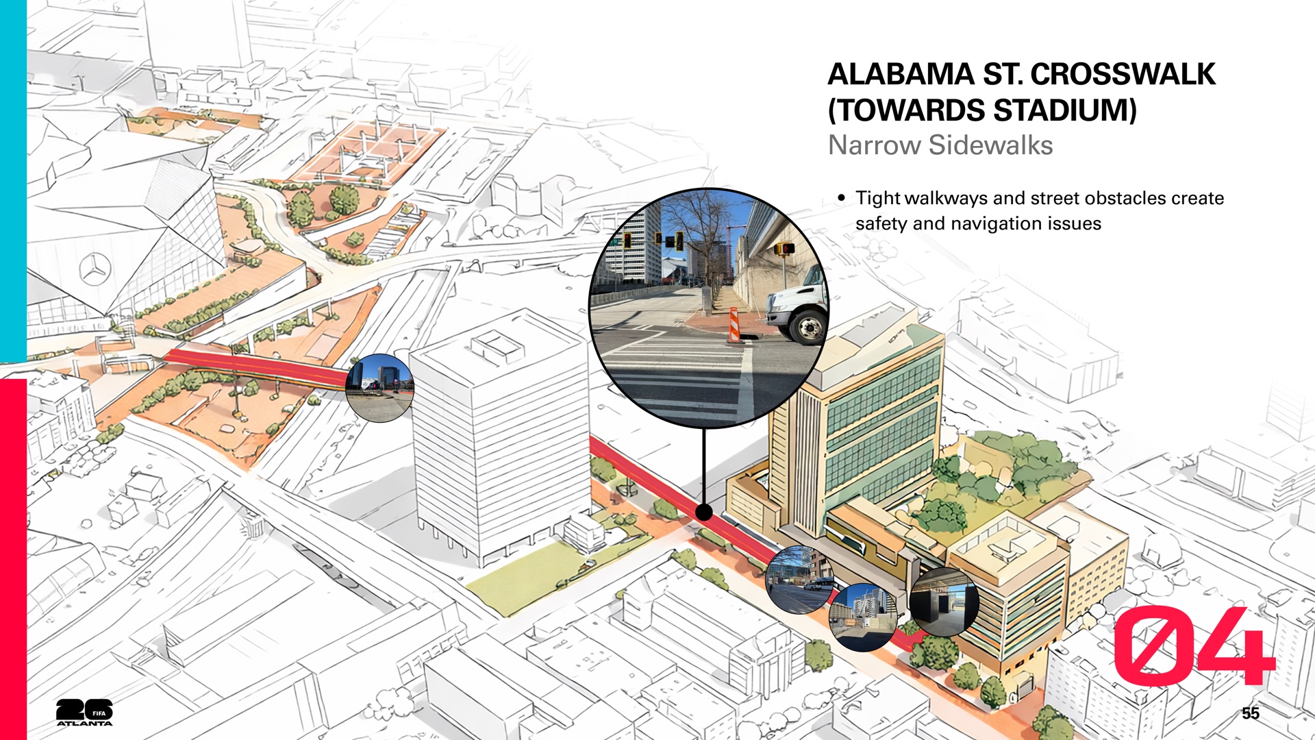
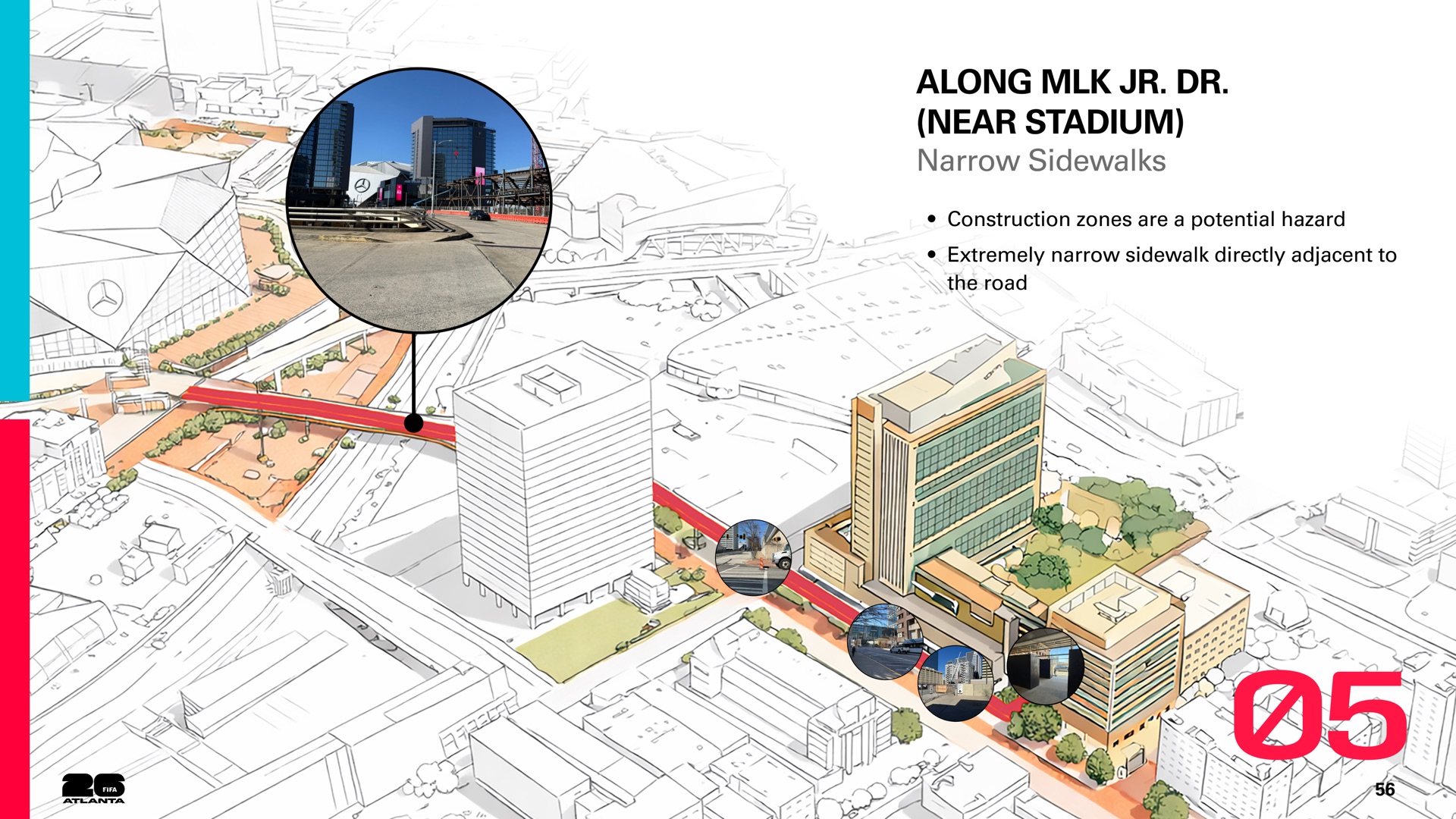
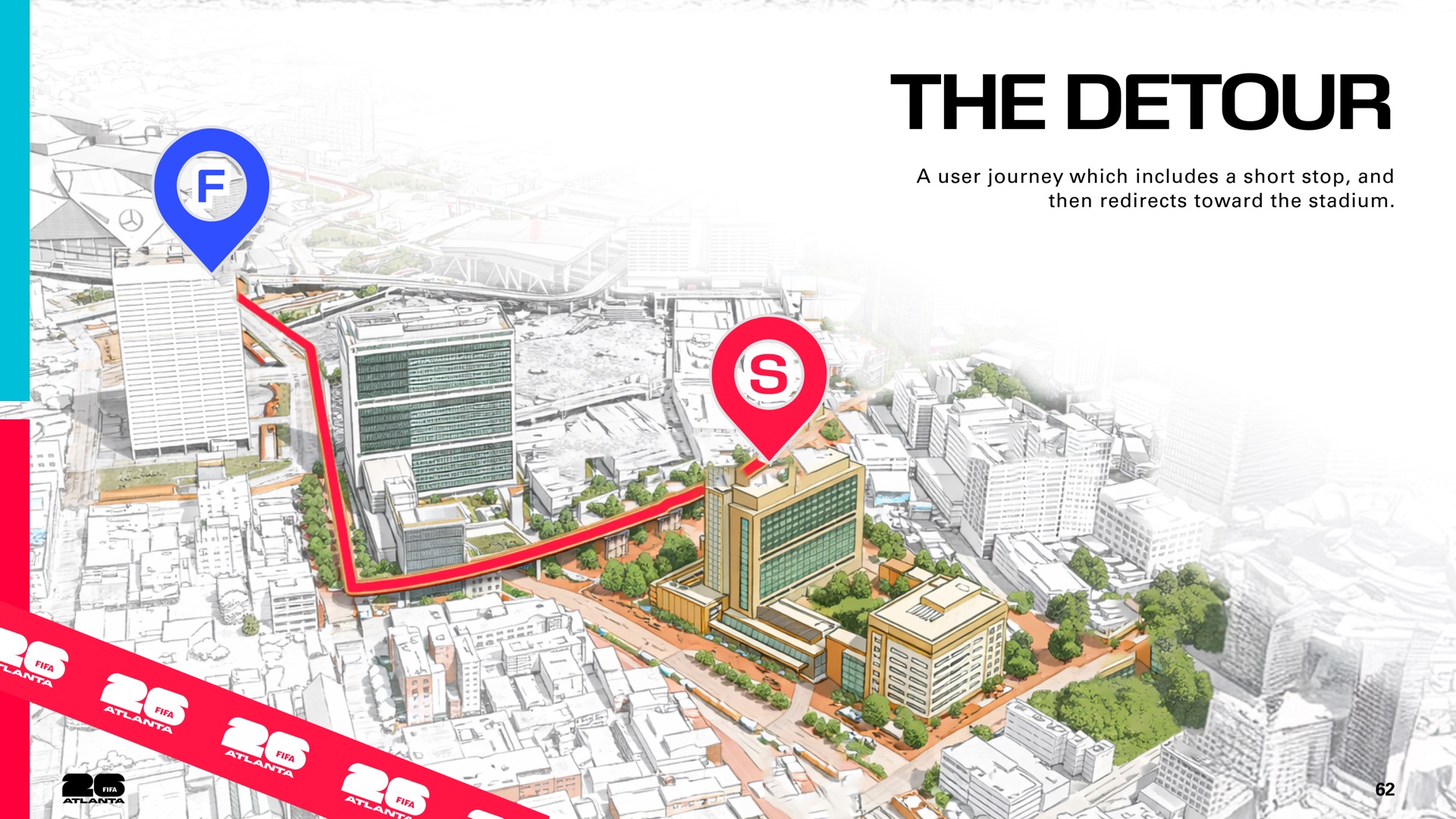
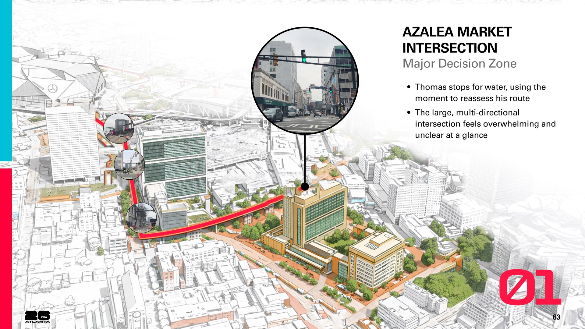
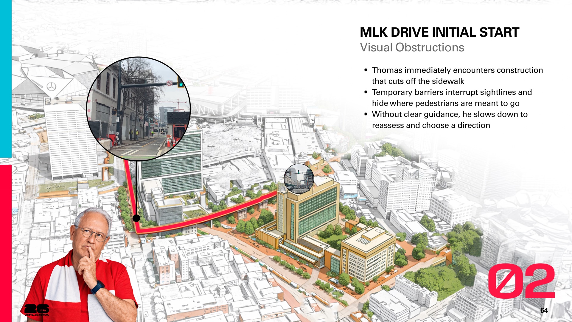
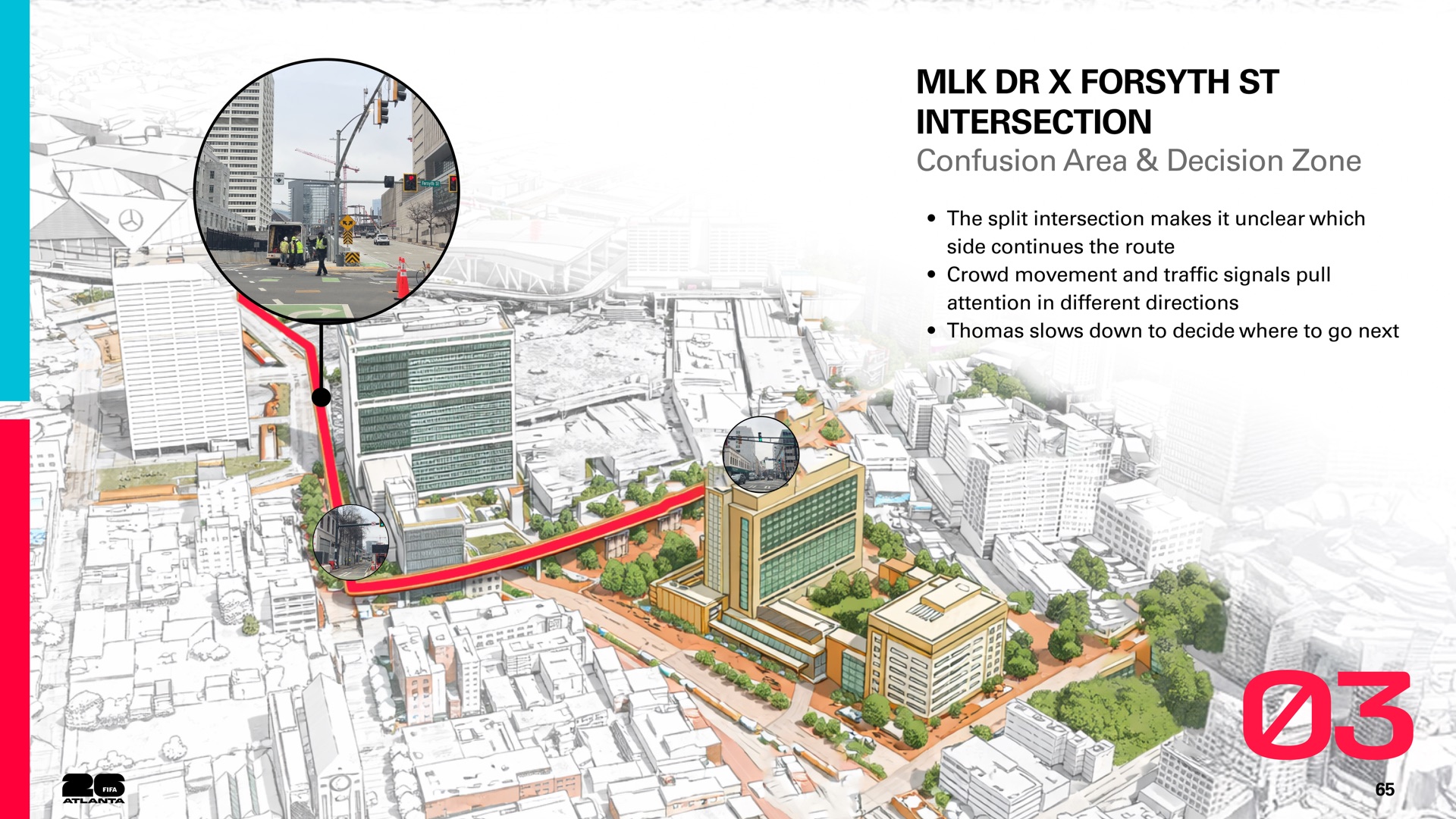
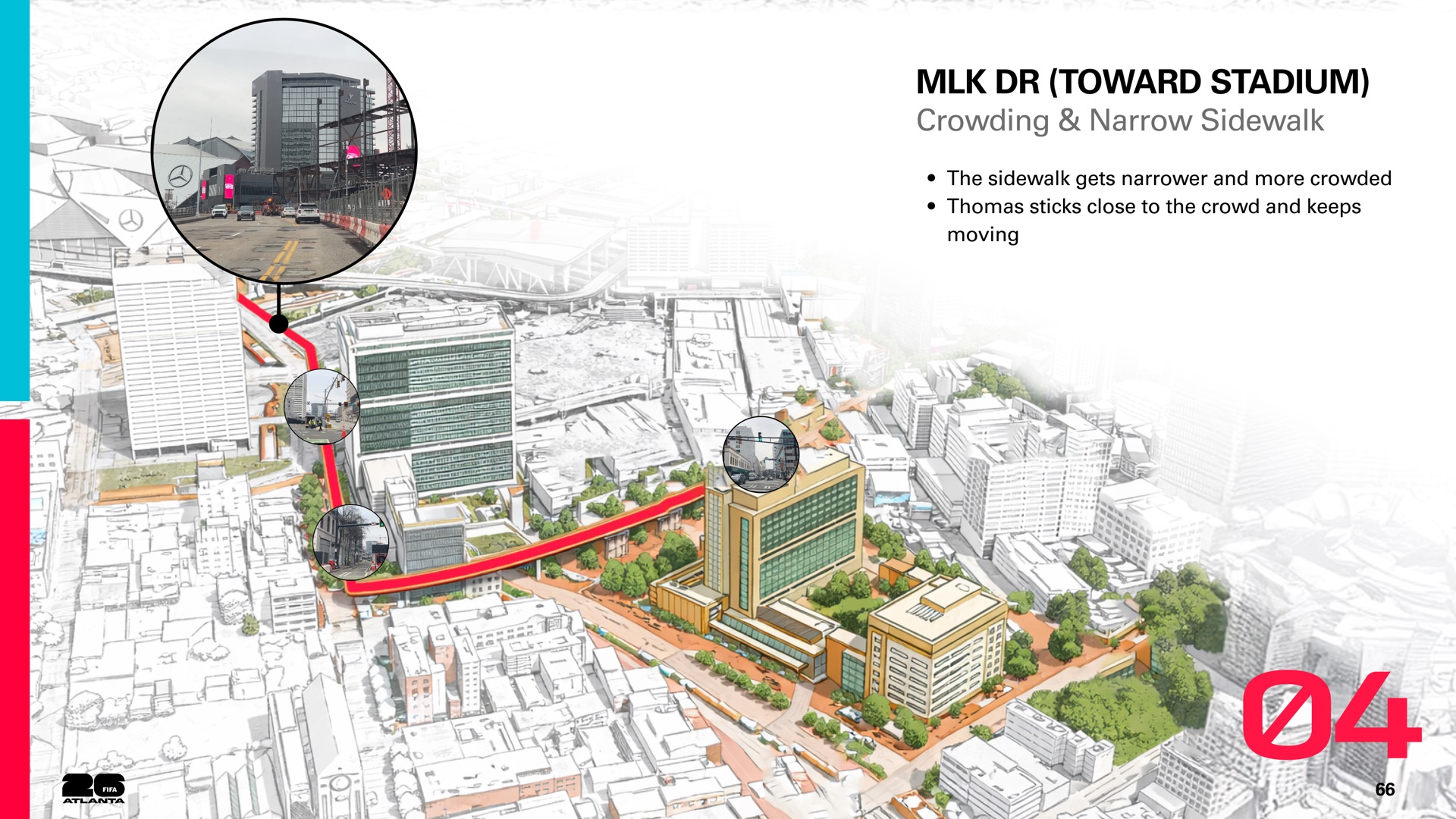
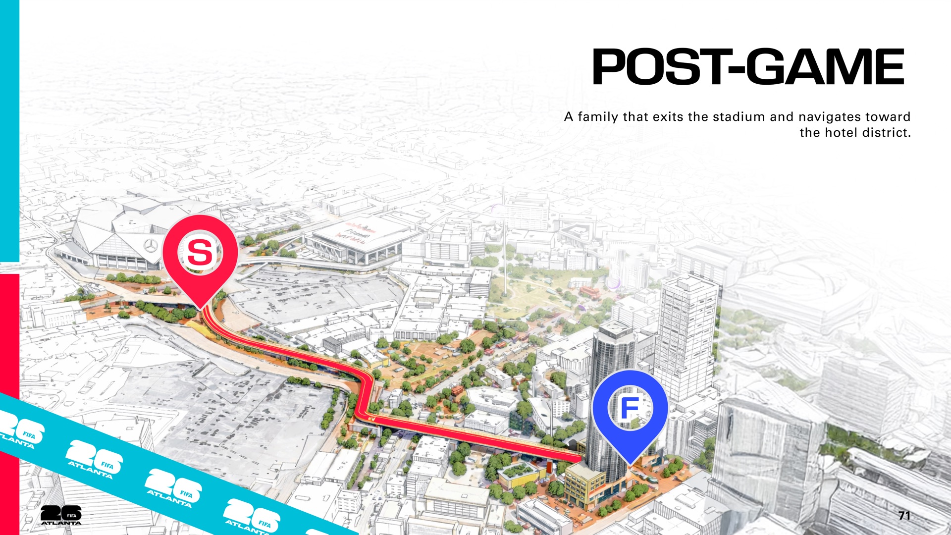
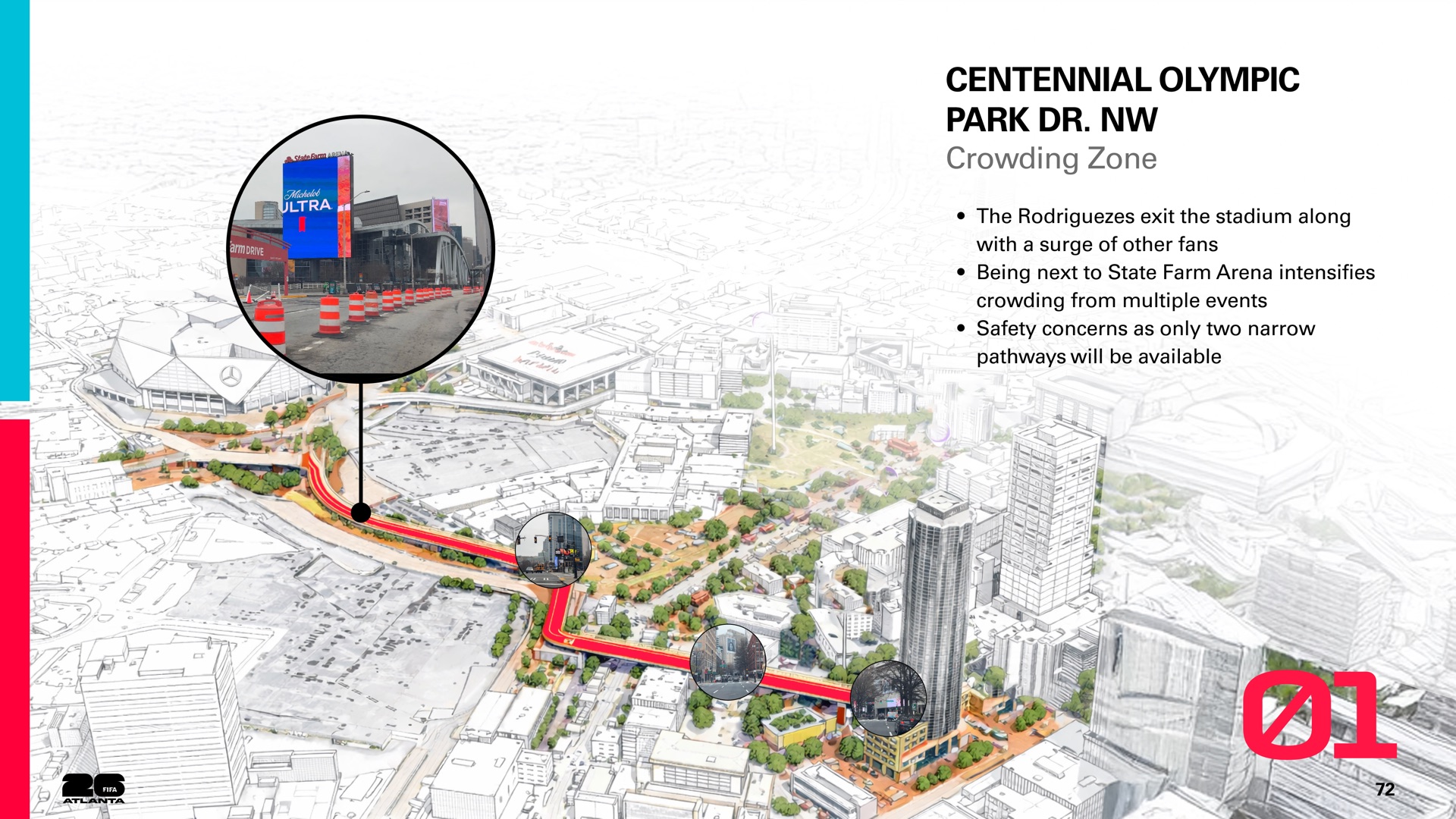

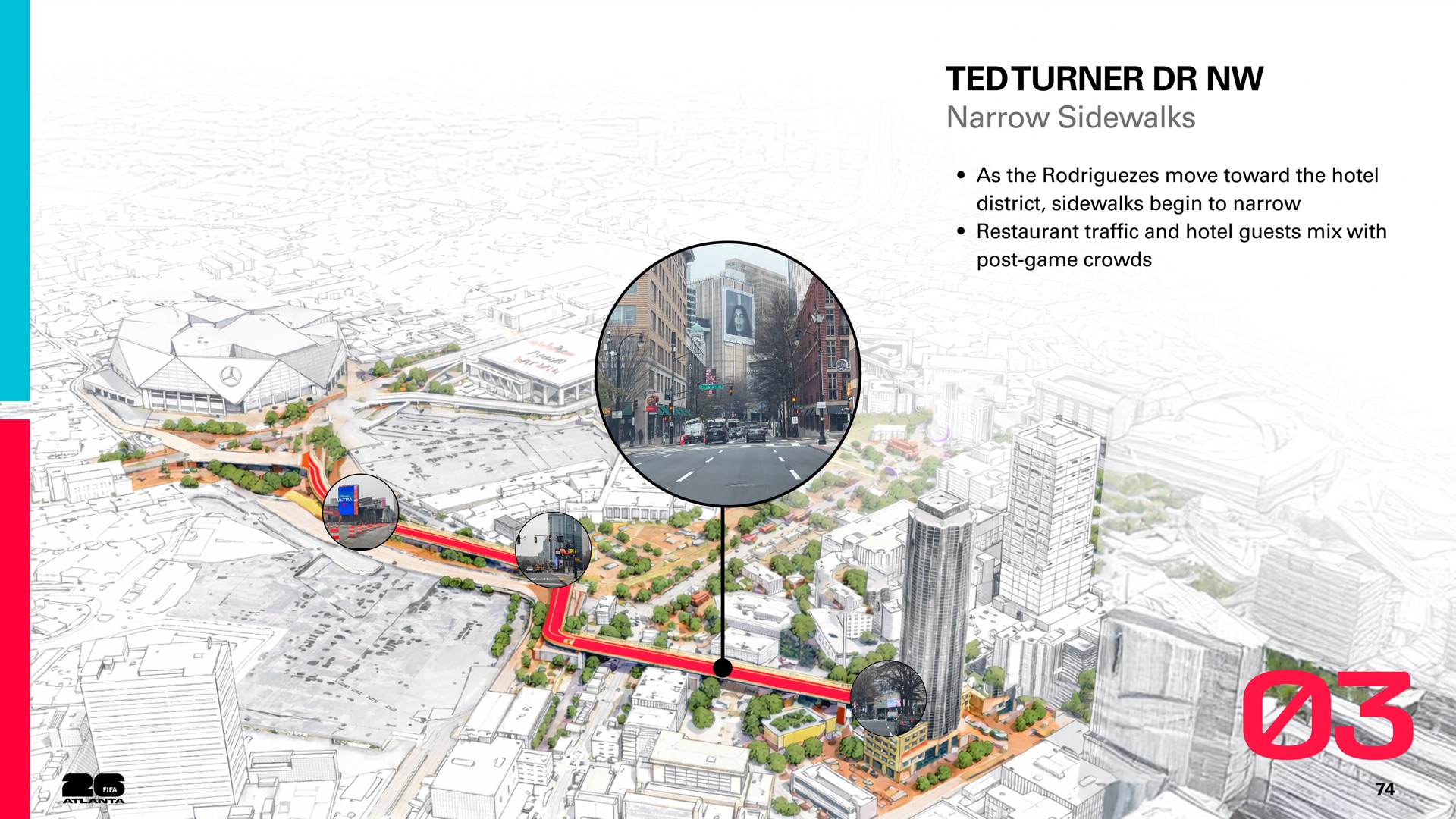
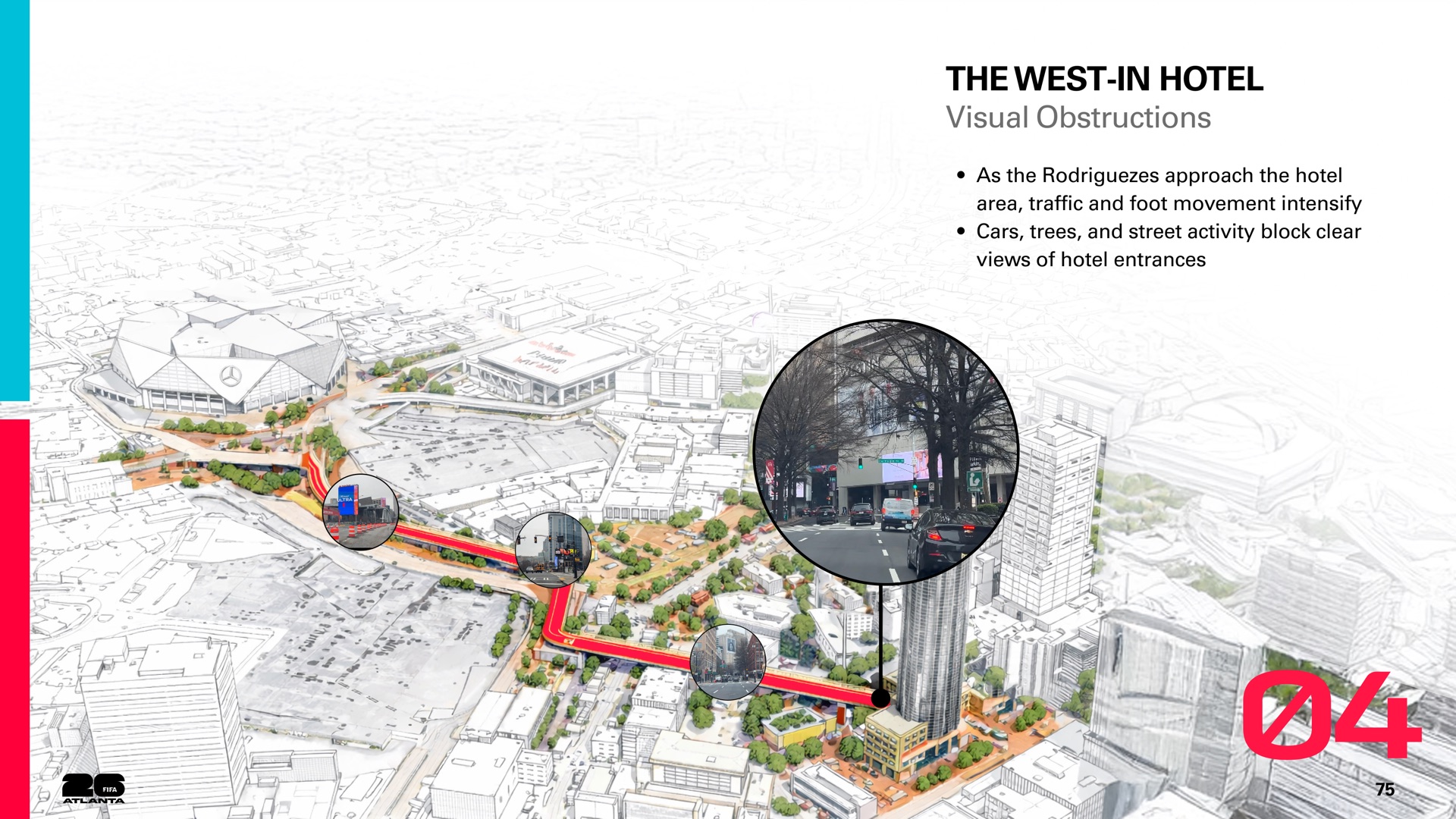
Every walk broke down in the same places: exits, crossings and narrow blocks. Those moments, not the whole route, became what we designed for.
06 · The Three-Zone System
How the Zones Guide Fans
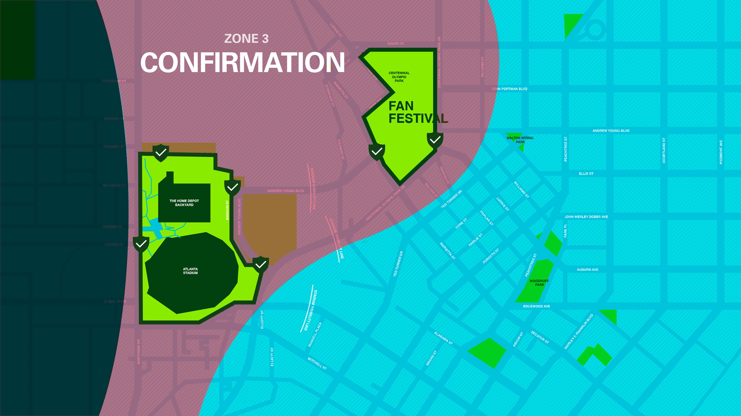
Fans need different things at different moments of the walk. We split the Last Mile into three zones so we could design the right information, signage and experience for each one.
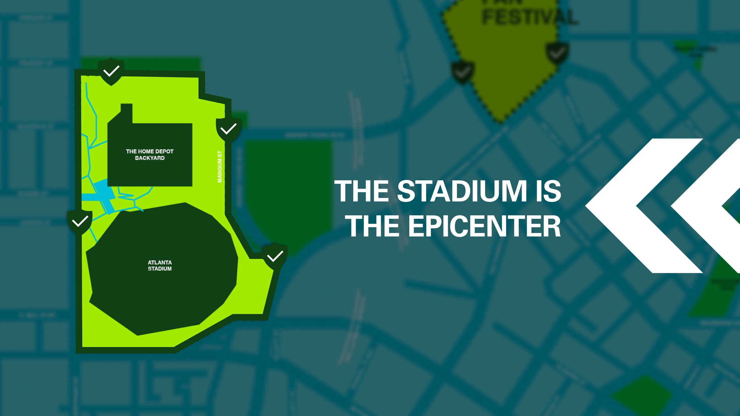
The epicenter
Everything Points to the Stadium
The zones ripple out from the stadium and the Fan Festival, so a fan always knows how close they are.
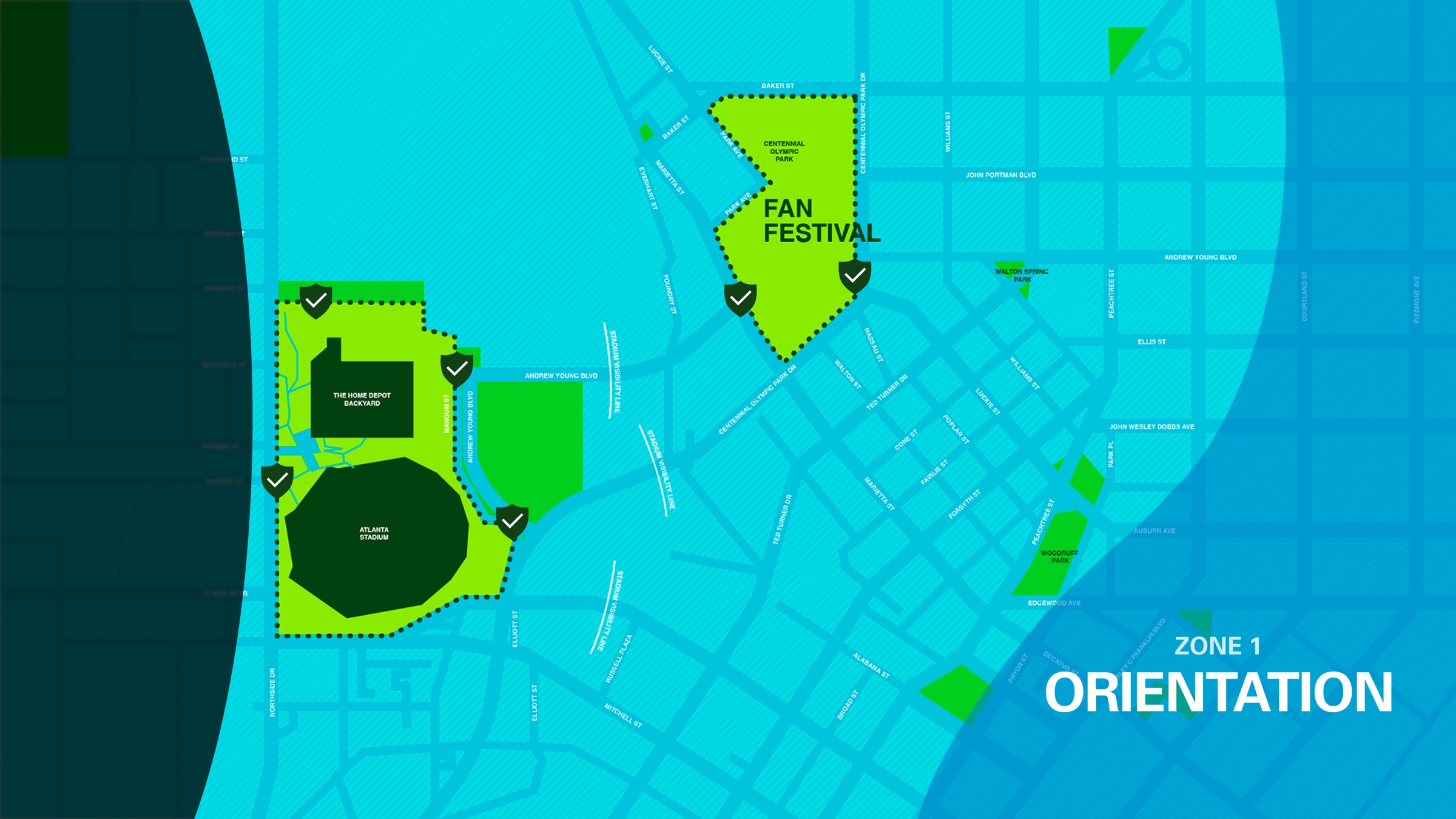
Zone 1
Orientation
Helps people understand where they are, where the destination is, and which way to head, from a distance.
Grounded. Assured. Guided.
Blue anchors Atlanta’s role as a global hub of movement and connection.
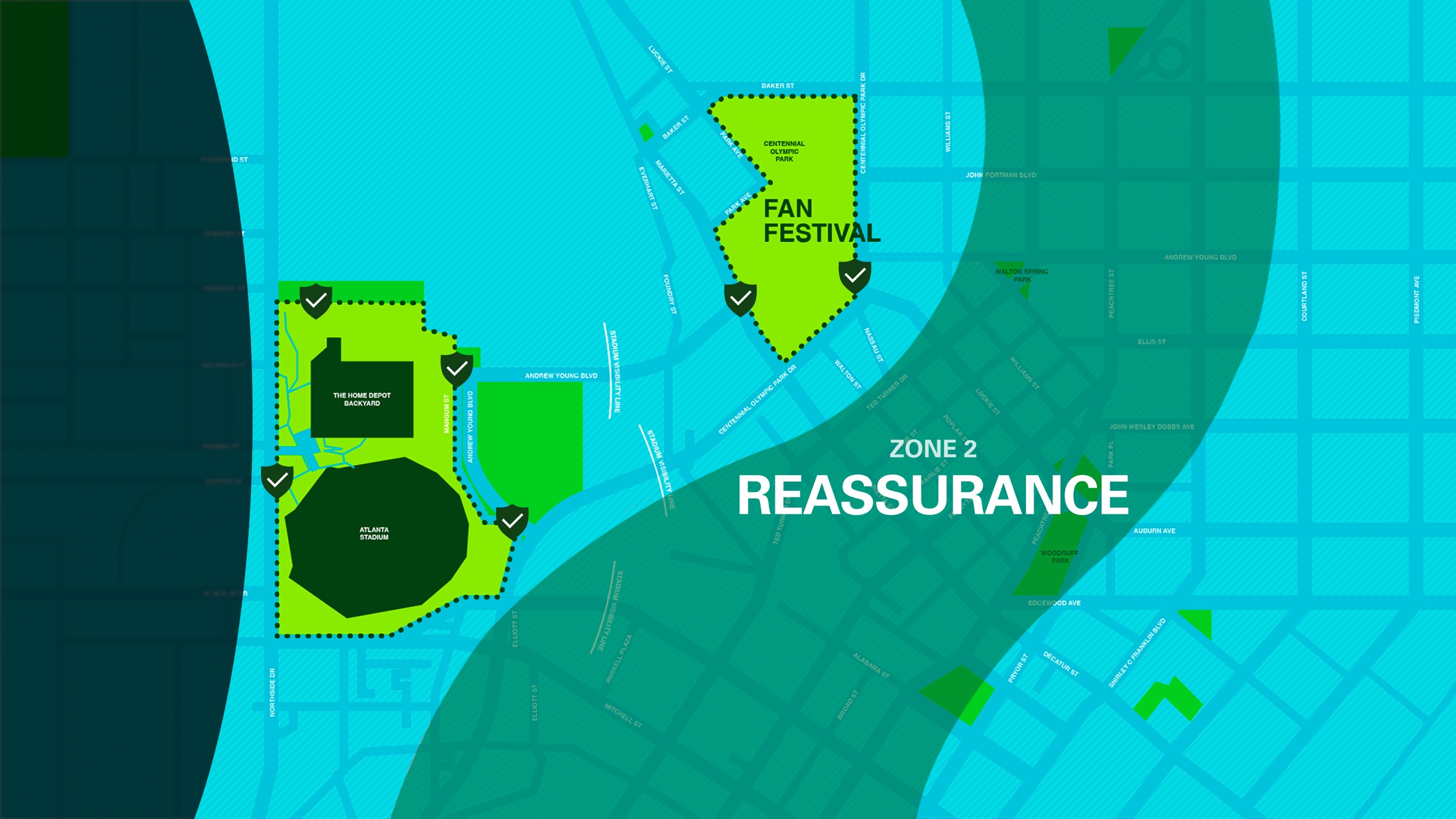
Zone 2
Reassurance
Confirms people are on the right path as they move, without making them stop or decide again.
Energy rising. Collective movement.
Green reflects Atlanta’s identity as the City in a Forest.
Zone 3
Confirmation
Validates arrival and final decisions, removing doubt at the most critical moments near the gates.
Intensity. Celebration. Arrival.
Red captures Atlanta’s cultural heat: sports intensity, music energy and collective celebration.
Pattern progression
The chevron pattern carries the zones into the street. It tightens and quickens as fans get closer, so the city itself feels like it’s pulling them in.
- Outside the Last Mile
- Zone 1 · Orientation
- Zone 2 · Reassurance
- Zone 3 · Confirmation
07 · Design Guidelines
Signage Toolkit
The guidelines tell the production team which kind of sign goes where, so the system holds together across a mile of streets and dozens of vendors.
Wayfinding as zone identity
Color, pattern and messaging tell fans which zone they’re in, so they feel the transition toward the epicenter.
Wayfinding as high-clarity direction
Decision points: signs at intersections where fans must choose a direction.
Path confirmation: signs that confirm the route toward a destination.
Vertical Totems
8–12 ft
Give destination confidence and act as references at major approach points.
Pole Flags
Fabric
Create a long-range directional pull without needing to be read up close.
Sculptural Waypoints
Inflatable or built
Visible from a distance, so fans orient themselves instantly.
Directional Blades
Pole-mounted
Reinforce decisions while people keep walking.
Fence & Barricade Wraps
Along corridors
Reassure passively through constrained stretches.
Ground Graphics
Sidewalk decals
Repeated cues at foot level validate direction without adding clutter.
A-Frame Signs
Weighted
Flexible, close-range messages for last-second routing changes.
Volunteer Hand Signs
Handheld
The strongest trust signal at moments of congestion or stress.
Ground Graphics
Near entrances
Confirm arrival and guide the micro-decisions at the gates.
Volunteer Hand Signs
Everywhere
People adapt to crowd behavior and disruptions in a way printed signs can’t, so volunteers work in every zone.
08 · Learnings
What I Learned
-
01
Design the Moment, Not the Map
What I saw
Fans didn’t get lost along the blocks. They got lost at exits, crossings and narrow stretches.
What I learned
Putting guidance at decision points does more than covering every street with signs.
-
02
Metrics End Debates
What I saw
With many stakeholders and opinions, every route could be argued for.
What I learned
Agreeing on six measurable metrics first turned opinions into decisions we could test.
-
03
People Are Part of the System
What I saw
At past World Cups, volunteers calmed crowds that signs alone couldn’t.
What I learned
The best wayfinding plans for humans as signage, not just signage for humans.
This isn’t signage, it’s choreography
It’s how Atlanta welcomes the world.